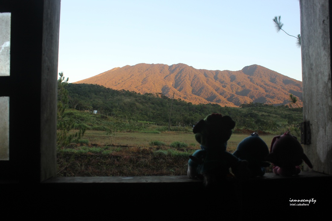
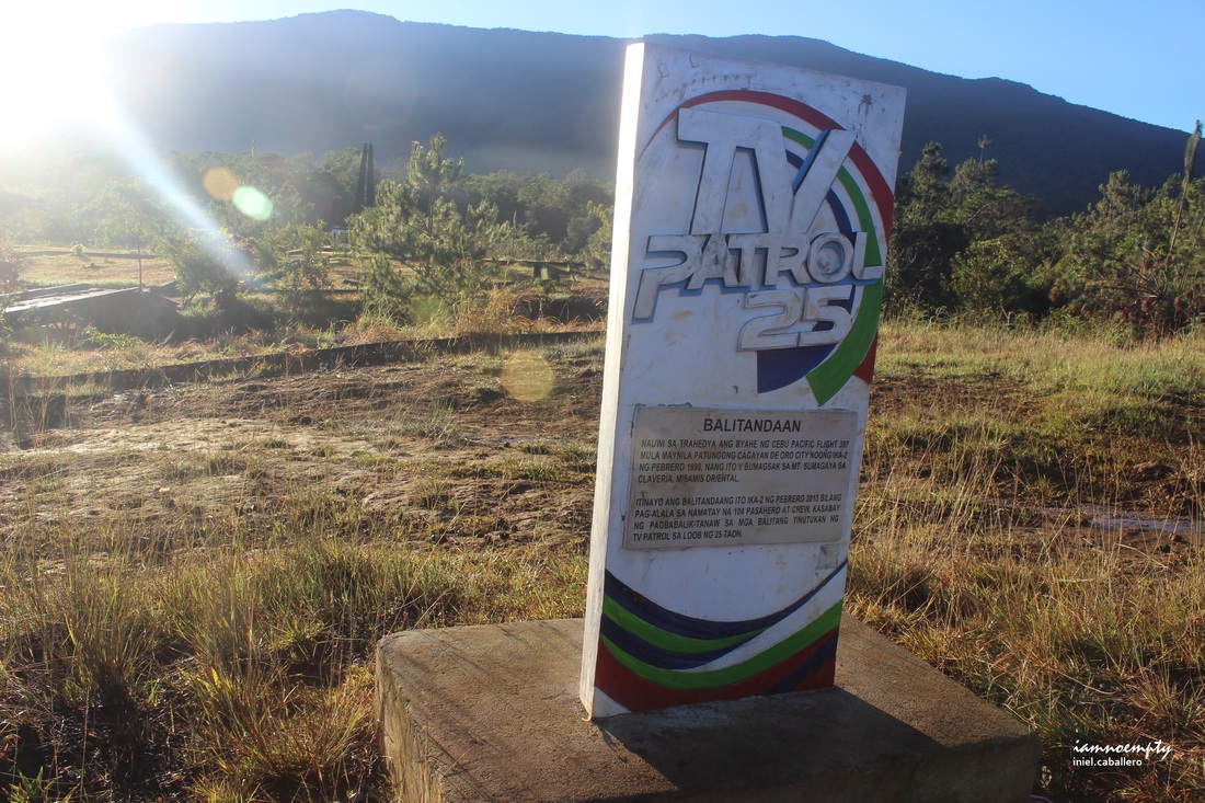
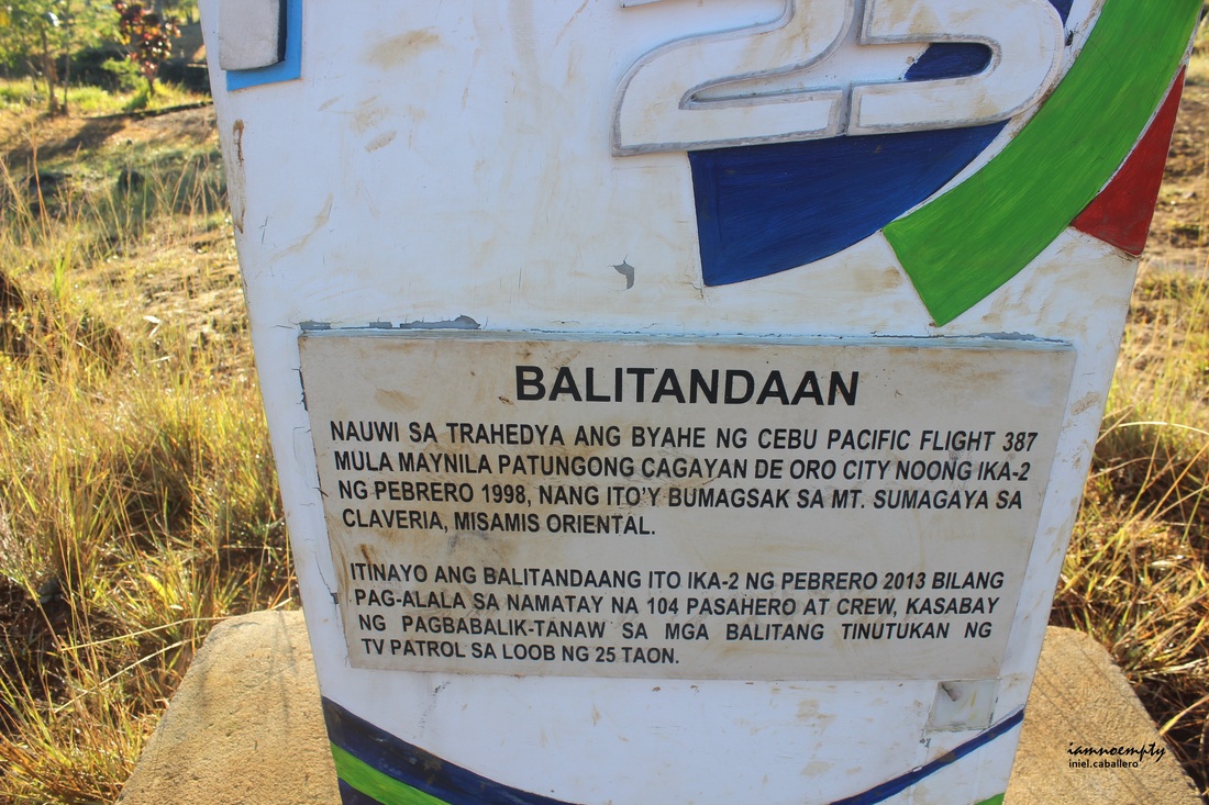
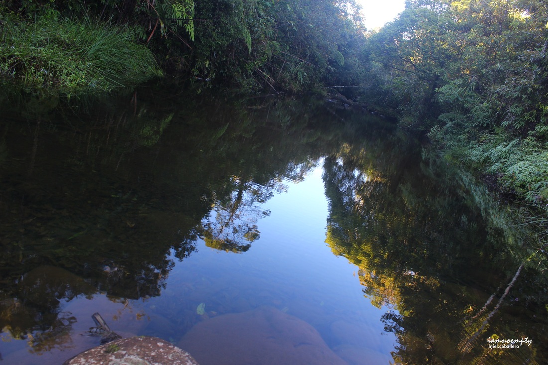
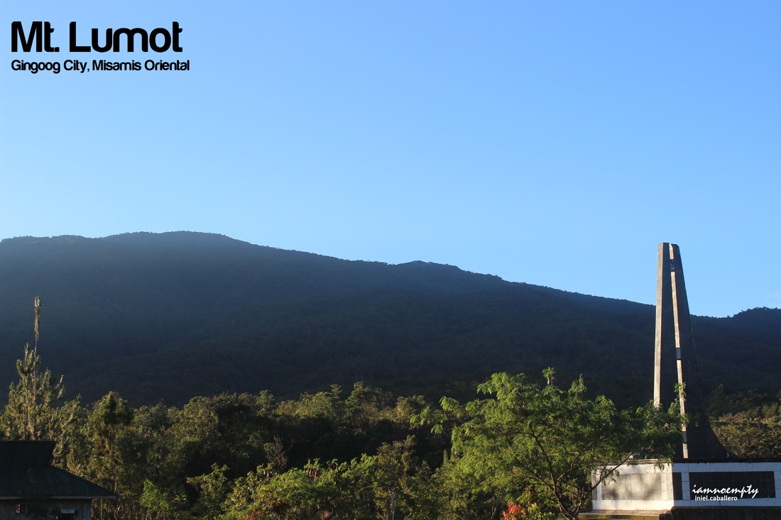
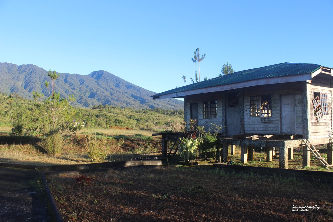
  Log Cabin Log Cabin Lumot means Moss and this mountain is named for one very obvious reason. There were climb attempts in 2013 traversing Mt. Lumot to Mt. Sumagaya however due to bad weather, injuries, hypothermia and even got lost those climbs were aborted. Luckily we were blessed with such a wonderful weather and able to had a great view of Mt. Lumot and Mt. Sumagaya's summit including its nearby mountains (Mt. Balatukan, Mt. Mangabon and Kitanglad range). 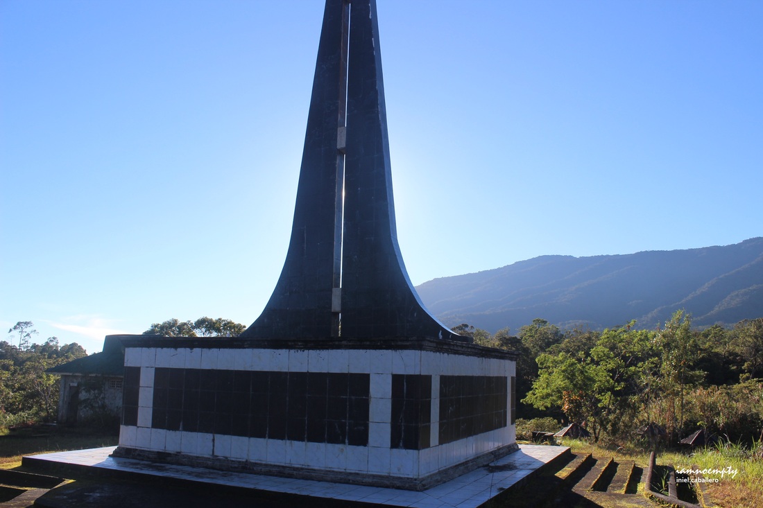 The Shrine The Shrine Mt. Lumot's jumpoff is located in Brgy. Lunotan, Gingoog about an hour habal habal ride from Gingoog City. Mt. Lumot became popular to hikers/mountaineers outside Gingoog City after the Cebu Pacific Flight 387 crashed last February 2, 1998 killing all passengers. Together with the Shrine, a Balitandaan marker of ABS-CBN can be found within the vicinity, commemorating the sad incident A small log cabin can be of used for overnight stay before commencing (no electricity, no cell signal, no CR, no water as of this writing) however a river located at the back of the Shrine can be of used for bathing or drinking.
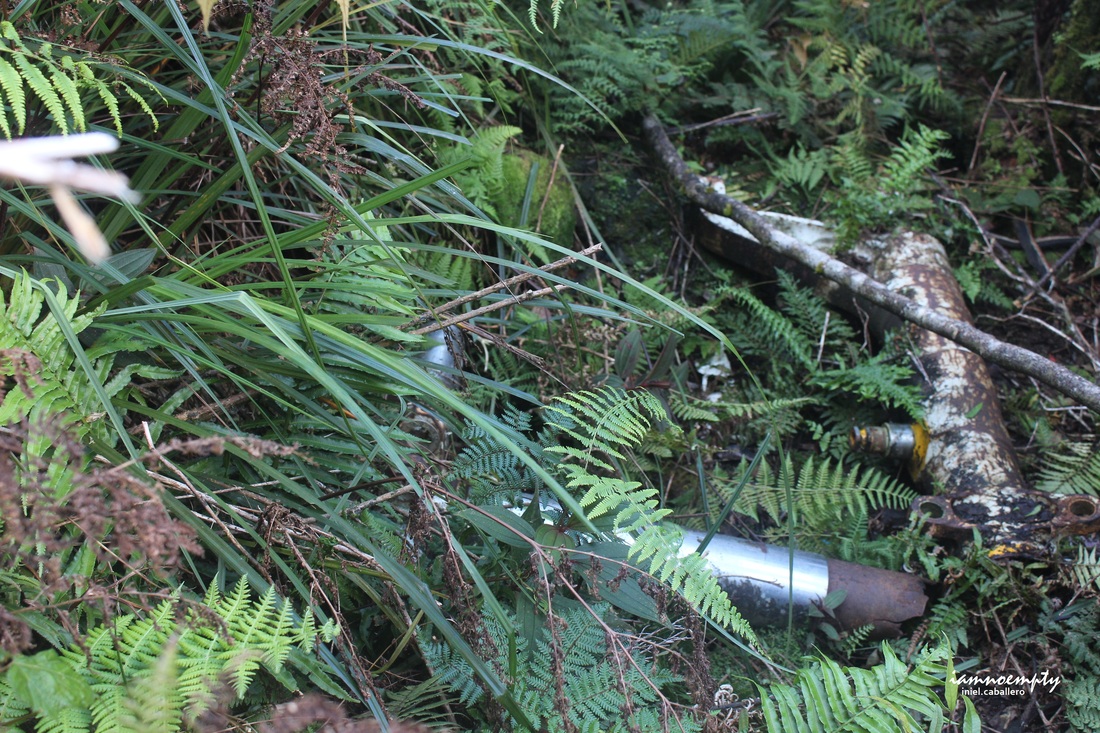
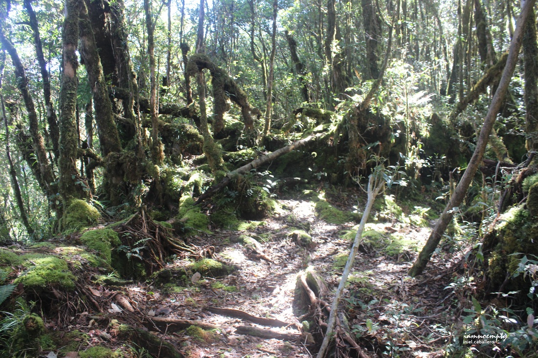 Camp Haribon Camp Haribon Comparing Mt. Lumot's trail to Dulang-dulang or Kitanglad is way different. Lumot challenges its visitor, not just how low temperature get but mainly its trail. Few gradual terrain can be experience while majority were more on ascent. Two major campsites with water sources namely, Camp Haribon (used by Haribond team when they conducted research) and Camp Nil Perez (named after the Nil Perez, a local guide who died during their Mt. Kanlaon climb). Camp Nil Perez is the last campsite before reaching the Impact Site.  Camp Nil Perez Camp Nil Perez Few debris can still be found, a Flight Attendant's coat. There where two impact sites within Mt. Lumot, however on the second site Plane's tire and some parts are still visible while the rest were brought down by locals in exchange for money. We reached the second impact site around 3:00pm were we had our Lunch/Early Dinner in one. Cebu Pacific Flight 387 - Debris
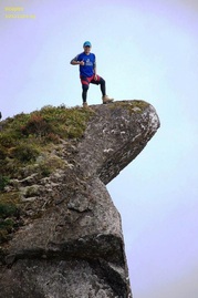
 Lumot's Summit Lumot's Summit My aim for Day 1 was to reach Sumagaya's Peak since based on research, Sumagaya's summit is an open area. I was hoping for a starry starry night since we started late and the terrain was indeed tiring, we had to call it a night and had to do an emergency camp near few meters away from a water source. Our Guide, Radzmr of KAPLAG Mountaineer, had to paved for us to settle for the night. It was a very cold and windy that night, the three of us went to sleep right away while our Guide and Porter cooked breakfast for tomorrow. Day 2: Mt. Sumagaya - Exit Point
0 Comments
Leave a Reply. |
This is my blog...
My Diary..... Travel... Climb... Swim..... My Adventures in Words Archive
February 2016
Mountains
All
Social Media Activities Instagram: @iamnoempty

Travel & Leisure |