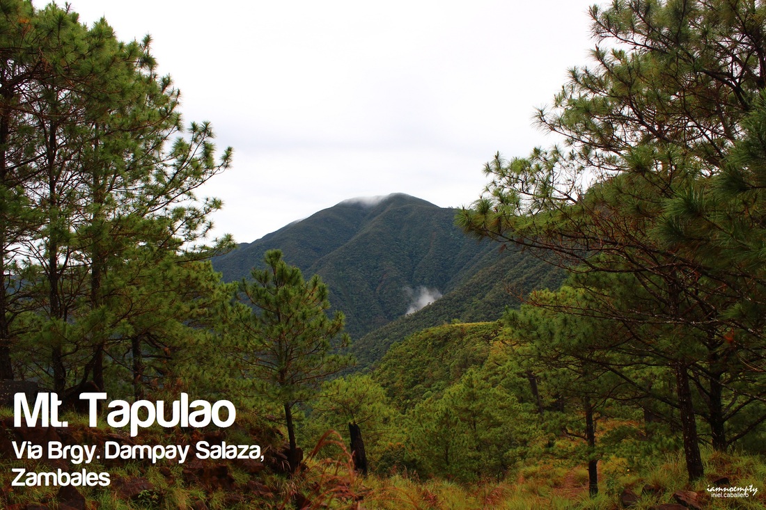
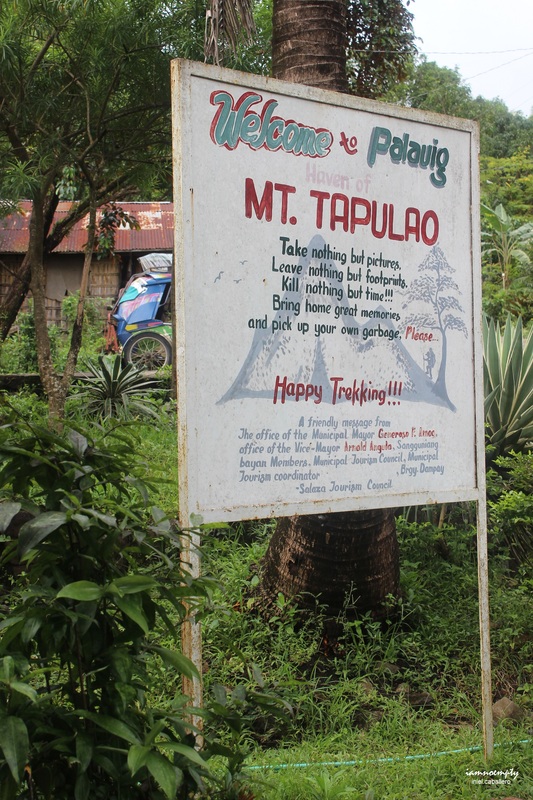
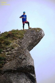
  Yung feeling na hindi mo matangap ang isang pangyayari at gusto mong balikan para maituwid ang isang pagkakamali. Buti nalang pwede ito sa pamumudok. A week after the failed climb, my mind was already set for another attempt and it will be Solo Dayhike. Left Manila around 8.13pm via Victory Liner - Caloocan full of positive thoughts and hoping for a nice weather. After registration, I started my trek around 2.20am. The temperature was so cold and sometimes it drizzled. If you'll ask me if I got scared while hiking alone at early dawn? Yes. In order to divert that feeling, I intentionally brought my xMini II (very handy though) speaker and played some music from my playlist (about 90% volume). Humming, singing made the first few hours of trekking light and supernatural-free. Well, let's talk about the trail. Every blog or write ups about Tapulao describe the trail as "Rocky". True indeed, from the trailhead at Brgy. Dampay-Salaza to Bunkers you'll be following a craggy terrain. As recorded, the ascend can be completed for about 7 - 8 hours, and that depends on your pacing (solo or as group). Descend can be cut into half, since ascend is more time consuming in terms of pacing than descend. 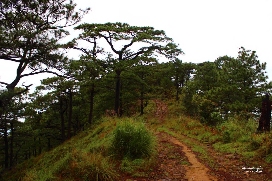 The trail can be boring, it seems like an endless path full of rocks but what's good about my trek, since I started at wee hours of dawn, I do not have a complete visual of the trail. The part of the trail where the lights from my headlamp and flashlight reached that's the only part I have accessed to, so I have this excitement on what was ahead. You'll hear frog croaking, crickets chirring, and some Jabra movements.... kidding, well who knows. Aside from being rocky, these stones are also slippery. The trail will be converted to some sort of streams when heavy rains pour on the area so be careful and balance yourself wisely. Also, make sure you are walking in the middle of the road, why? Landslide..... a huge pile of rocks and a tree that was uprooted blocked me when I was descending. This happened because it was raining hard that time, again be careful. Your craggy-suffering will end by the time you reached the portion wherein Tapulaos are visible. Yehey!!!! From here, all your sufferings from the harsh-pounding-knee-torture trail will be forgotten. These landscapes, the view, the forest.... just like one of the mountains up North..... so relaxing, such a wonderful creation. 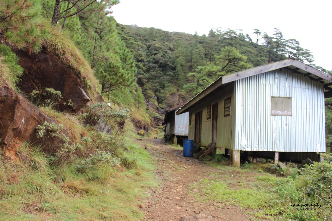 Bunkhouse However, this is not the end.....walk ahead..walk, walk, walk furthermore then you'll see a Guard House. This is your indicator that the Bunkers are just few meters away. The Bunkhouses area has a Bathroom, 3 bunkers, a water source, a mini falls and if you go further down from the left you'll see a river. All under the shade of the Tapulaos.... The last leg of your climb will start from here. Positioning in the middle of the road, to your right: Bunkers while to your left is a trail going up. Scramble all the way up until you reach a small open space that has an uprooted Tapulao tree. 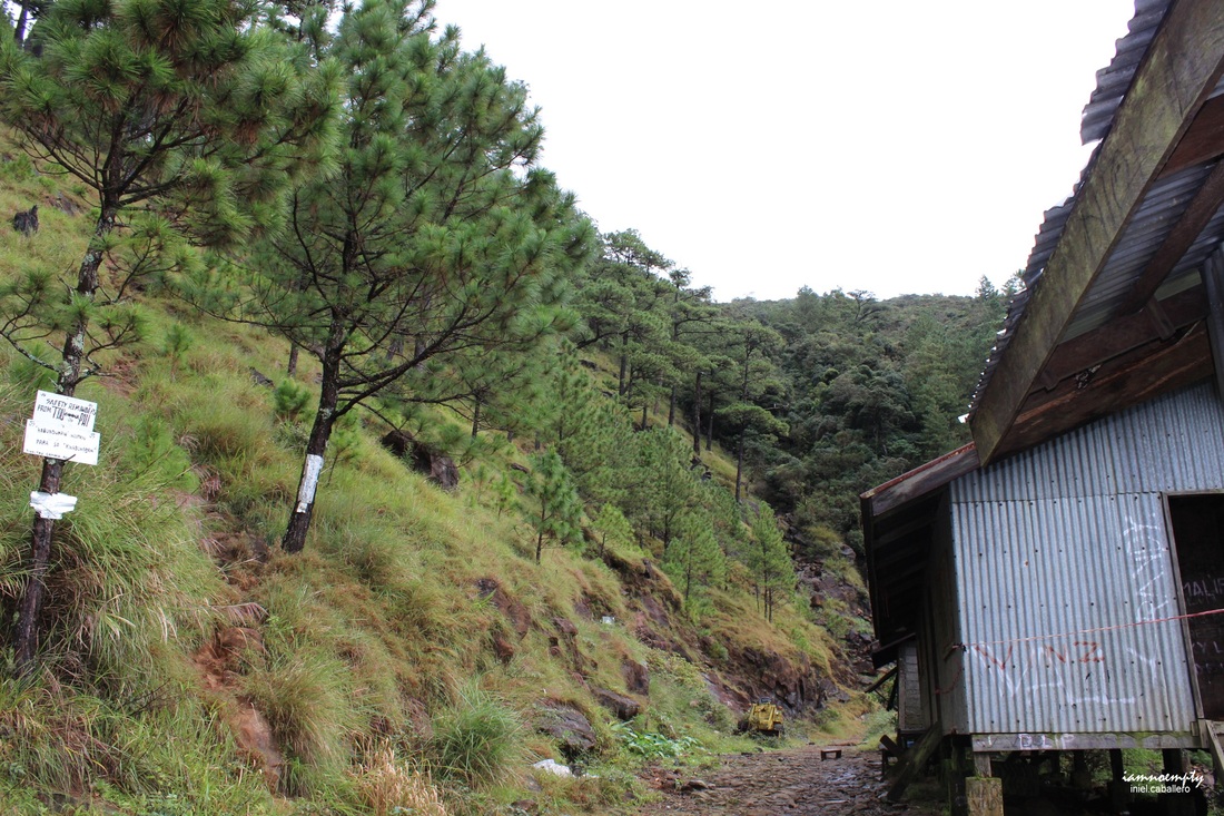 Right: Full ascend to open space (Note: if you want an easier access to the open space, prior reaching the Bunkers to your right you will see a neatly piled of rocks serves as a wall or steps, you can use this trail to reach the open space. If you wish to access the summit the very hard way.. from the mini falls walk further , there's a trail that will lead you to the summit. This is seldom used because of its difficulty) Once you gain access to the open field, a path can be seen right after the uprooted Tapulao. Welcome to the Mossy Forest. Yes! it's indeed a Mossy one and creepy specially when fog tries to blanket the area. The path inside the mossy forest is well paved. Follow it heartily until you will reach an open area (Summit? No), by the time you enter the open area, to your right you'll find another path. Follow this path until you reach the Summit. YEs! summit na!!!! sa wakas!!!!  Entrace to Mossy Forest (Note: you will see a series of Neon Pink Ribbon with marks TF then a number, These are not trail signs. These are signs left by the UP-DENR personnel who conducted some research on the area. During my climb, I saw one set of these ribbons leading to the Summit. These ribbons were left as an indicator for the next batch of researchers noting that the portion where ribbons were present has been documented already. Another set of researchers will be hiking this coming Thursday according to Ate Beth, the POC of the Center, to expect another set of these ribbons in the future. A hiker got lost when he mistook these indicators as trail signs, arrived at the center soaked with limatiks all over his body. 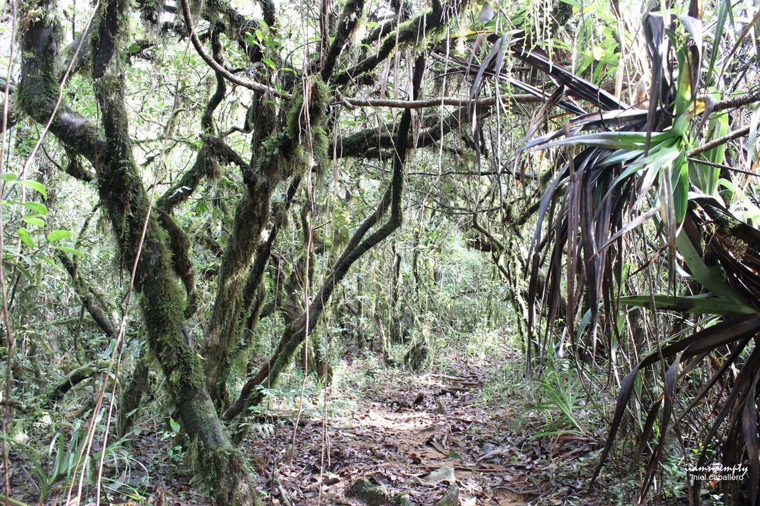 portion of the mossy forest I think the Mossy forest will consume at least 30 mins. The summit consist of two or three small open spaces while the rest are covered with shrubs and trees. My usual question every time I climb a mountain is, How will I know that I am already at the summit? A large Cross? A Telco Tower? A signage? For Tapulao, you will see a crater. Something similar to Mt. Tagapo's Summit, my guess is that the crater was caused by a collapsed earth from within since Mt. Tapulao was once had a large-scale chromite mining operation. From here you will have a 360 view of the entire area, the sea, other mountains. I stayed for 15 mins only, took some pictures and a brief rest. My mind was set that I need to reach the Registration area by 2.30pm, avoiding the possibility that I will still be trekking when night falls. 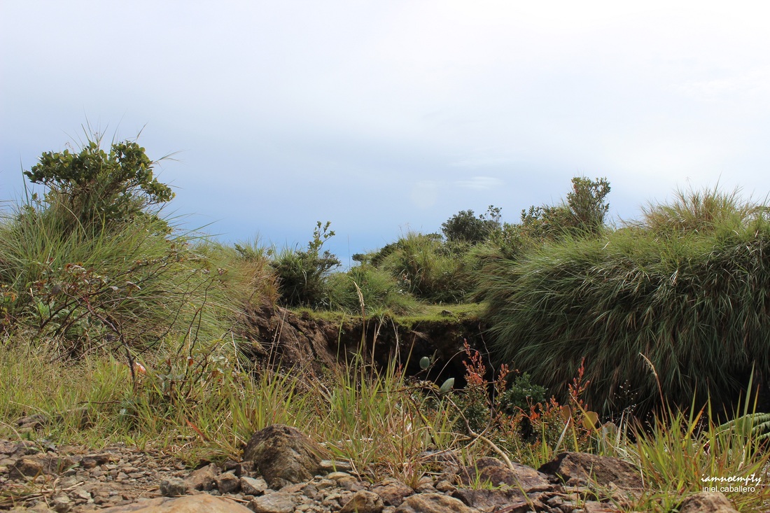 Tapulao's Summit and the crater Rain started to pour and by the time I existed the Mossy Forest, the Bunkers were nowhere to be found. The entire place was covered with thick Fog. I took a slow descend then by the time I gain accessed on the main trail. Paused and Thanked Mt. Tapulao for my successful climb.... laugh all you want but yes I gave my thanks to the Guardians of Mt. Tapulao. From bunkers, I started running all the way to cut my trek short. I run most of the time, yet I was very careful on parts were the rocks were too loose and or slippery.  My Climb Buddy, Chocobo By the time I reached the Center, my feet were aching and trembling. Soaking wet from sweat and rain yet fulfilled because I never thought I can finish the entire trek for 11 hours. A mountaineer/friend once told me I will never conquer Mt. Tapulao because of its trail.... Thanks to him, challenge accepted..........and accomplished.  My Personal Itinerary: 20:13 - Left Manila (Victory - Caloocan Terminal) 01.25 - Arrived at the ZAMECO (with 20 minutes delay because Pampanga was flooded at that time due to heavy rains, Bus and other heavy type vehicle were able to pass the waist deep flood along SM Pampanga.) 01.40 - Left Drop Off (I forgot to contact the tricycle driver) 02:15 - Registered 02.20 - Start Trek 05.57 - Reached 10 km 06.47 - Reached 12 km 08.06 - Reached 15 km 08.20 - Reached Bunkers 09.15 - Summit 09.30 - Descend 13.35 - Registration Center. 7 Hours Ascend and 4 hours Descend Note: Water sources are available, I forgot to take note the distance from Jump off to the first water source. When ascending, it is located at the left side with a sign in it. - Breakfast was along the trail while I had my lunch when I reached the Registration Center. 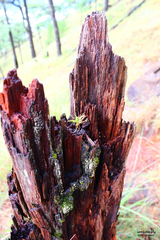 How to Get there: Option 1: 1. For hikers who wishes to start the trek early dawn, take Victory - Bus (Caloocan Terminal) - Route: Manila - Sta. Cruz, Zambales. - They have hourly schedule trip - Terminal for AirCon buses (Express Bus) not the one parked outside the Mall. - Fee: 379.00 - Inform the conductor/driver that your drop off point is Dampay-Salaza Resettlement Area or ZAMECO - A Welcome to Dampay Salaza signage and a waiting shed will be seen from the drop off point. On the opposite side of the highway is the ZAMECO office/mini powerplant. 2. From drop off, you can start your hike all the way to the Resettlement area. - The tail starts from a concrete road to a rough one. The trek will consume for about 2 hours or more. - Other option is to ride a Tricycle. > If you opted to hire a tricycle, I suggest you need to arrange it prior arriving. > Fare is 250.00 per tricycle (good for 3 persons), 250.00 rate if you are travelling during dawn or night time. 200 per tricycle during daytime. 3. Leaving Brgy. Dampay-Salaza - Again, you can hike all the way to the main road or rent a tricycle. - Same rate applies Note: Waiting for a bus from the highway may be tiresome and bigger possibility that you will be in standing position since people will be flocking for a ride at Sta. Cruz Terminal. - The tricycle can be rented from Brgy. Dampay-Salaza all the way to Victory - Iba Terminal for 400.00 pesos per tricycle. (I forgot to ask if they have a separate rate for dawn/night time) Option 2: A. Private vehicle. - Make sure that it can cater rough terrain - A parking space (for free) is available at the Registration Center. 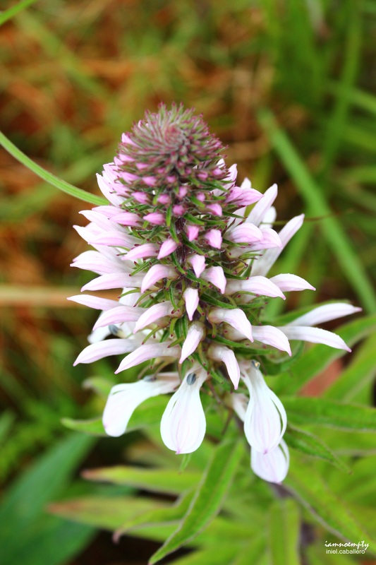 Other Concerns: 1. Wash Room - Center has 1 bathroom - Ate Beth sells shampoo and soap - Cold sodas are also available 2. Electricity - The resettlement area has one. - Bunkers: None 3. Souvenir - In progress: available items will be key chains, shirts, eco bag 4. Sleeping area - In case your dayhike fails and wishes to stay at Brgy. Dampay Salaza, the center offers a room with pillow, blanket and mosquito net (forgot to asked if rate applies or free of use) 5. Route - Mt. Tapulao summit can be accessed via Tarlac, if you planned to traverse it. (3-4 days trek) (will try this soon) - Via Bagsit River, according to Pastor Edy a trail is available however it very difficult. - Bagsit River offers several mini pools by the way..... this can be consider as side trip. You can ask Mang Ben to guide you all the way up to the different catch basin. 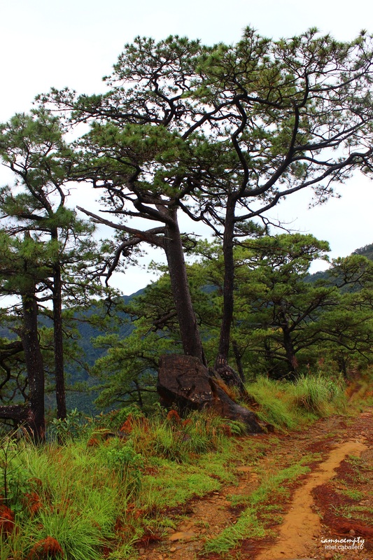 Contact numbers:
1. Van : Ka Pepeng +639196147752 - During our first attempt, we hired a Van for 3,500 per day - A 10-seater van - A cheaper option for group climb 2. Tricycle : Mang Ben (Forgot the name) : +639286367781 - He's very accommodating 3. Pstr. and Mrs. Edy Badar : +639107757212 - President, Dampay Salaza Tourism Council - Make it a point to have his number incase you got lost.
6 Comments
10/3/2012 12:33:07 pm
someone anonymous said love makes us human, courage makes us extraordinary. your love for hiking is one of a kind - idk how to connect it with humanity but dude you overflowed with courage when you hiked this mountain solo. who can top that now besides master Arnel.
iamnoempty
10/4/2012 12:04:15 am
Sir,
hunter
8/15/2013 07:35:22 pm
ang tindi mo tsong' nag trail ka mag isa?? 8/15/2013 09:50:53 pm
Sir,
Pyds Cayetano
3/9/2014 02:44:04 pm
Good Afternoon sir, Congrats on your solo climb. Lakas! Sir balak din po namin mag dayhike this coming weekend sa Tapulao. Un una kasi namin akyat sa Tapulao may rented vehicle kami so hindi ako familliar ngaun sa pag commute. Ask ko lang po sana: 3/9/2014 04:55:54 pm
Hi Pyds, Leave a Reply. |
This is my blog...
My Diary..... Travel... Climb... Swim..... My Adventures in Words Archive
February 2016
Mountains
All
Social Media Activities Instagram: @iamnoempty

Travel & Leisure |
