  Transfer na ng heavy packs sa jeepney Last mountain to conquer........ We had our lunch sa Poblacion ulet then packed our belongings para iiwan sa hired Jeepney since eto ay traversed (Lobo - Dada Traverse). Rest, refill ng water then we're all set to conquer the next summit.  Sa libro and postcards ko lang to nakikita noon. Marami na din ang gusto ng umayaw sa huling akyat dahil sa sobrang pagod na but then our team lead (Sir Ace) was able to convince them including me na it will be an easy trek (compared sa first 2 mountains) plus mapuno along the way kaya hindi mainit.
All 11 participants went up, together with the 2 guides, stated the trek at around 2.30pm.
9 Comments
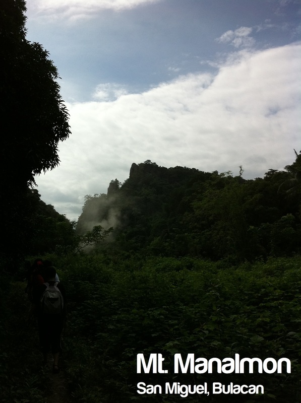
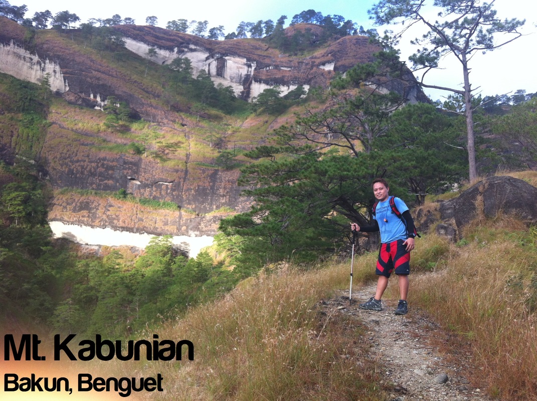 Mt. Kabunian Jump Off Point : Poblacion, Bakun 1840 MASL Para sa iyong kaalaman: This mountain is popularly known as the "home of the kankana-ey god, Kabunian." Parts of the breathtaking huge rocky mountainsides used to be burial grounds, hence the presence of box coffins and human bones. Its rocky peak is idyllic for the hardy rock climbers and mountain trekkers as a challenging destination and campsite. - Source: www.benguet.gov.ph January 14, 2011 - Day 2
Quarter to 10pm when I decided to sleep after a tiring, "wasak" climb to Mt. Tenglawan. Prior sleeping, uminom muna ako "alaxan" (Ibuprofen + Paracetamol) just in case pagising ko kinabukasan ay magkaroon ako ng muscle pains then took a bath. (Freezing cold pero pinilit ko pa rin maligo) Woke up at around 2.30am then the team ate Pancit Canton with Itlog na pula and kamatis. (Note: Itlog na pula is maalat, very good lalo na sa pagiwas ng cramps) 3.30 am we started the trek then..... 2 Guides (isa sa unahan, isa sa huli) as mandated by the Barangay Captain. Mahaba habang hagdanan ang aming tinahak kaya napaisip na kami kung gaano to kahirap pagnakabalik na kami since slope kung slope ang hagdan (pano pa kung akyatin to pabalik?) Mas mabilis ang lakad namin nung umpisa since madaling araw, walang view na nakikita masyado (hindi mo mapapansin kung kaano kataas/lalim ang pinakamahaba na hanging bridge) kaya walang stop-over for Photo Ops na nagyari. 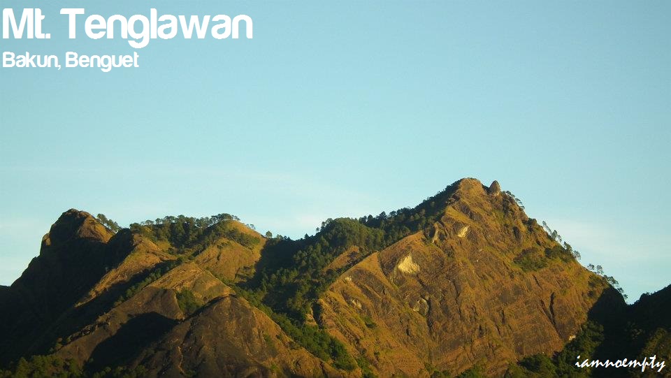  Bago ang lahat.... papasalamat muna ako kay Sir Erwin at sa Packers Mountaineering, headed by Sir Ace for inviting me sa akyat na to. For more information about the group, visit its Facebook account (Click HERE)  November of 2011 I received the Event Invite via Facebook kaya mula noon I did some research. Read blogs about Bakun Trio, things to bring , etc. pero isa lang ang nakalimutan ko, kung gaano kahaba ang oras ng travel.
Although may itinerary naman, hindi ko na inisip ang travel time. So, travelling from Manila (Victory Bus Terminal in Cubao) - Baguio - Poblacion, Benguet total hours traveled was.... drum roll please..... 11 hrs! 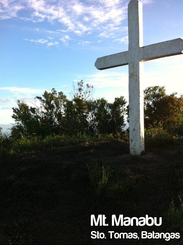 Manabu Peak Sto. Tomas, Batangas Jump-off point: Sulok, Brgy. Sta Cruz, Sto. Tomas LLA: 13.9777°, 121.2413°, 760 MASL Days required / Hours to summit: 1 day / 1-2 hours Specs: Minor climb, Difficulty 2/9, Trail class 1-2 source: www.pinoymountaineer.com Para sa Inyong Kaalaman: The name Manabu is said to be abbreviated from 'Mataas na Bundok'. It is one of the three major peaks of the Malipunyo range (the other two are the Malipunyo summit and Susong Dalaga peak) - www.pinoymountaineer.com Third day and Final day na noong MFPI Mid-year Presidential Meeting ng magdecide kami ni Sir Erwin na umakyat pa ng isang bundok since parehas naman kaming nakaleave for work. 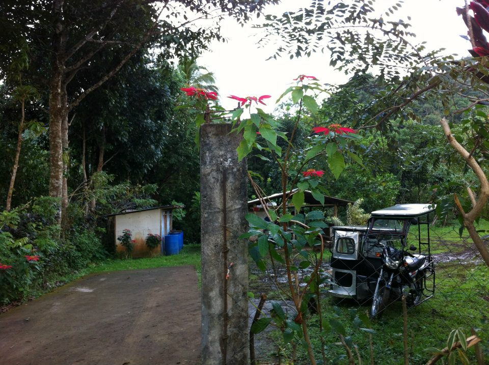 Sulok, Manabu's Jump off Point Sulok, Manabu's Jump off Point After leaving the area, we took a bath sa may baba ng Camp for 5 pesos only then hired a tricycle from Mountaineers Stop Over and Store going to Cuenca Public Market. Sumakay kami ng Jeep bound for Lipa Batangas at bumaba sa may Mcdonald nilakad kunti papuntang Big Bell at bumili ng food for our Manabu Climb.
Sa kabilang side ng highway may mga tricycle na nakapark at pwede tong ihire going to the Jump Off point. Ang Jump Off point going to Mt. Manabu is sa may Sulok, Brgy. Sta Cruz, Sto. Tomas. Kung sasabihin ng mga tricycle driver na may kailangan magregister pa kayo sa isang barangay maginsist kayo na dalhin deritso sa Sulok kasi doon talaga ang area for registration. 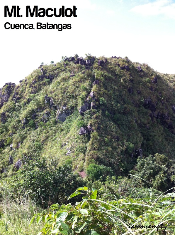 Mt. Maculot Cuenca, Batangas Jump-off point: Brgy. Poblaction, Cuenca LLA: 13°55'15"N; 121°2'30"E; 706 MASL Days required / Hours to Rockies: Half day / 1-2 hours Specs: Minor climb, Difficulty 2/9, Trail class 1-3 source: www.pinoymountaineer.com Para sa Iyong Kaalaman: Many Coconut trees are on the area that from a distance you can see the mountain with Curly hair. It is also said that curly-haired aborigines (Aetas) once lived in this mountain, hence it was named Maculot from "kulot", meaning curly. - http://gilas-mountaineers.webs.com A member of MFPI (Mountaineering Federation of the Philippines, Inc.) invited me to join sa Mid-year Presidential meeting last November 25-27, 2011 sa Mt. Maculot, Cuenca Batangas.  Originally, it was supposed to be a 5-day event at dapat sa Mt. Makiling, Laguna but due to some internal reason nalipat sa Mt. Maculot. The primary reason why I joined ay para makasama sa Mt. Maculot at madagdag eto sa listahan ng mga bundok na naakyat ko. First time ko sumama sa mga ganitong event kaya excited at kabado kasi wala akong kilala ni isa sa mga taga MFPI at ang naginvite sa akin was a mountaineer by hobby at na met ko sa social network. So technically, hindi kami close. (Peace Sir Erwin)  Maculot's Jump Off Point Ang meeting place namin was sa Jam Terminal sa Buendia-LRT station. For about 2 and a half hours and 140.00 na fare we reached Public Market ng Cuenca. Bumili na muna kami ng ready to eat na food for dinner then we hired a tricyle papuntang jump off point. (Mountaneer's Stop and Store). A registration fee of 10.00 pesos is required.
We started to hike papuntang Voltaire's Camp dahil dito ang venue para sa Mid-year Presidential Meeting ng MFPI. It was just a short walk and during the short walk tatanong na ako ng mga benchmarks for climbing. First time ko din umakyat with someone na mas tenured sa akin in terms of climbing so I grabbed the opportunity to ask as many questions as possible. MT. CRISTOBAL Dolores, Quezon; San Pablo and Nagcarlan, Laguna Major jump-off: Brgy. Sta. Lucia, Dolores, Quezon LLA: 14.064° N 121.428° E, 1470 MASL (600m gain) Days required / Hours to summit: 1-2 days / 4-5 hours Specs: Minor climb, Difficulty 4/9, Trail class 3 Source: http://www.pinoymountaineer.com ----------------------------------------------- Ang akyat pong to ay parang Halloween Special (an overnight stay), 4 days after All Soul's Day. Pinili namin ang Mt. Cristobal because of its Spooky Stories.... Mt. Crisobal or San Cristobal or mas kilalang The Devil's Mountain by many is the "Alter Ego" of Mt. Banahaw. Situated kaopposite ng Mt. Banahaw, mountain that contains a lot of positive energy, Mt. Cristobal is the opposite. Maraming Ghost Stories ang naassociate sa bundok na to at ang pinakamaskilala ay ang "Tumao". Tumao is like "BigFoot" sa western urban legend.  Dolores, San Pablo City We started our trip from Jam Liner (Cubao - Near GMA Network) around 7.30am heading to San Pablo City at ang pasamahe ay 135.00. Pagdating sa San Pablo City, bumaba kami sa may Dolores.
Since tatlo lang kami, hindi na kami ng rent ng jeep so we waited for a tricycle/jeep na maghahatid. Nagtanong nalang din kami sa isang pulis na na nakastation sa area kung pano makapunta dun. Sabi nya, either special na tricycle o sasakay ng Jeep na may nakalagay na Number 2 na sign.
--------------------------------------------------------------- Another Summit was reached last September 25, 2011. At around 5pm Me, my Akyat Buddy Thyrone and 2 new friends Lynn and Rob left Manila via Five Star Bus bound for Cabanatuan. It was my first time to meet Lyn and Rob, kaya exciting kasi may bagong makikilala na naman ako at possible na makakasama sa mga next na akyat. After 2 hours or so na travel, we reached Bgry. Kamias, Bulacan. Rode a tricycle papuntang Jump off.  Rob, Lynn and Thyrone Rob, Lynn and Thyrone Reaching the jump off point, kailangan mag register and in order for you to register, kailangan magcross sa lake. 3 ways to reach the other side: Barefoot, Raft or Monkey Bridge.
Erase barefoot kasi malalim ang tubig, Raft (checked) pero si Lynn lang ang nagraft because she was scared na mag monkey bridge. Monkey Bridge (checked) for us guys since we wanted adventure sa lakad na to... kaya si Lynn ang nagiging photographer sa monkey bridge buwis buhay naming tatlo. 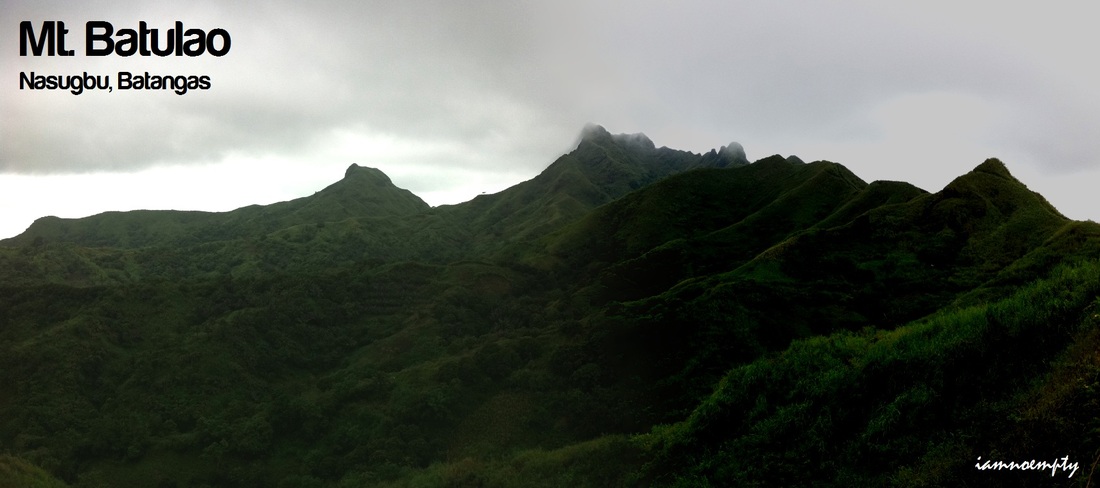 Jump-off point: Evercrest Golf Course, Nasugbu LLA: 14.0408 N 120.8011 E 811 MASL Days required / Hours to summit: 1 day / 2-4 hoursSpecs: Minor climb, Difficulty 4/9, Trail class 3 with 60-70 degrees assault Source: http://www.pinoymountaineer.com/ Para sa inyong kaalaman: Batulao’s name was derived from “Bato sa Ilao” (Illuminated Rocks) which later on became abbreviated to “Batulao.” According to local residents, every yearend the sun sets right between Batulao’s two peaks, creating a spectacular image of rocks surrounding a disc of red light. This was supposed to be an overnight stay sa Mt. Batulao pero dahil sa kasagsagan ng Bagyong Mina, My bundok buddy, Thyrone and I decided na gawin nalang day Hike para matuloy lang kasi ayaw namin imove ng ibang araw.
Naakyat na ni Thyrone ang Mt. Batulao kaso hindi nila naabot ang summit sa kadahilanang si Thyrone at ang kanyang groupo ang nakakaalam, so gusto nyang ulitin. Ako naman, Mt. Batulao was my first summit and off we go. 4:00 am na kami umalis dito sa Makati papuntang EDSA-Taft MRT station para sumakay ng bus Going to the Jumpoff point sa Evercrest Golf Course (PhP 106.00) then rode a tricycle papunta sa portion kung saan magstart ang Trek (PhP 50.00). From there start na nagtrek, umaambon at foggy.... hindi maaraw kaya masarap magtrek. |
This is my blog...
My Diary..... Travel... Climb... Swim..... My Adventures in Words Archive
February 2016
Mountains
All
Social Media Activities Instagram: @iamnoempty

Travel & Leisure |