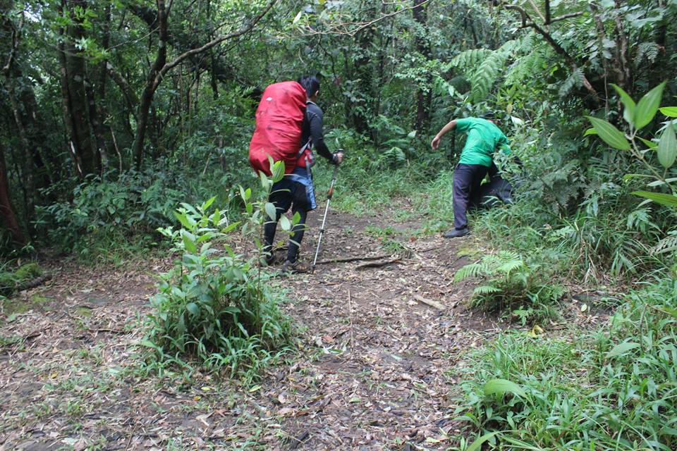
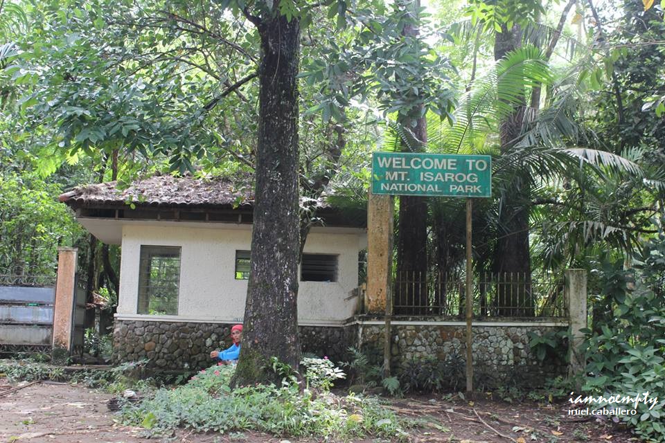
 DENR Research DENR Research Many times I heard of this mountain yet never had a chance to research or at least have an idea what this mountain in store however It was then became an alternate destination after Mt. Palali climb was canceled due to Typhoon Santi. As per our guide, Jeffrey Sifuego of Isarog Guardians, there are 4 known trails from different municipalities; Panicuason Trail (Naga), Patag-patag Trail (Tigaon), Calabanga and Goa.  Coming from our guide's mouth, to reach the summit via Patag-patag trail, this trail needs to access Camp 4 (Panicuason Trail) then Summit. As per PM's article, Patag-Patag trail will lead to Patag-patag peak and not the summit, so I guess our Guide was correct. A traverse can be done as well from Panicuason to Goa however our guide was not sure where the exact trail meet, because a different arrangement/permit is needed when existing to Goa (A Goa-registered guide will meet the group if GOA traverse is planned). The jumpoff for Mt. Isarog via Panicuason Trail is at the DENR Station. This is also the jumpoff if you plan to visit Malabsay Falls. During the 10 - 20 minutes hike, we saw few abandoned stations/research offices before leading to the forest. The trail is well established however few diversions can be seen before reaching Camp 1. I guess some of these trails leads to falls and possible streams or somewhere else. The Camp Sites - There are 4 Campsites with water sources each
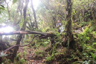
There are at least 4 Campsite with water sources each. From jump off to Camp 1, trail is from gradual flat terrain to few slopes. passing through Bamboos, and tall grasses. From Camp 1 to Summit, the terrain will be in full assault. A short yet dangerous rock wall awaits along the trail between Camp 1 and Camp 2. Though a vine-rope was installed, slippery rocks make it more dangerous specially during decent in full pack. Among the 4 Camps, 3rd Camp is the only camp that can accommodate few number of tents (possible 4).  Mossy forest from Camp 4 to Summit Mossy forest from Camp 4 to Summit Hikers will be passing through a mossy forest from Camp 4 to Summit. Either crawling under or hopping unto the fallen-covered-with-moss logs added some spice during the summit assault. Before reaching the highest point, an open portion provides a good view of Naga, this part is called the Vintana.  The "Vintana" The "Vintana" The Summit is entirely covered with trees, a very good indicator that the people of Naga are still concerned with the mountain (however, few illegal logging were recorded already). From Vintana, one has to scramble all the way up to reach the highest point, which is still covered with trees. To get a better view, climb the highest tree and from the top you'll see Mt. Mayon. The Summit
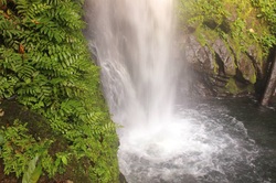 Sidetrip to falls rewards every hikers, Malabsay Falls is just 10 mins away (approx. 300steps) from DENR's gate. For washup, hikers may choose either Girls Scout of the Philippines (GSP) office or the nearby resort. Other sidetrip destinations would be the Panicuason Falls, Hot Spring or Stroll around Naga City and visit few old Churces.
0 Comments
Leave a Reply. |
This is my blog...
My Diary..... Travel... Climb... Swim..... My Adventures in Words Archive
February 2016
Mountains
All
Social Media Activities Instagram: @iamnoempty

Travel & Leisure |